Introduction
Till now, no substantial research has been done to obtain near
real-time regional TEC mapping in Asean region and to find out the
GPS positioning errors on L1-band during geomagnetic storms. This
research proposes the development of a model that will be useful
for many GPS dependent applications for civilian users wherein,
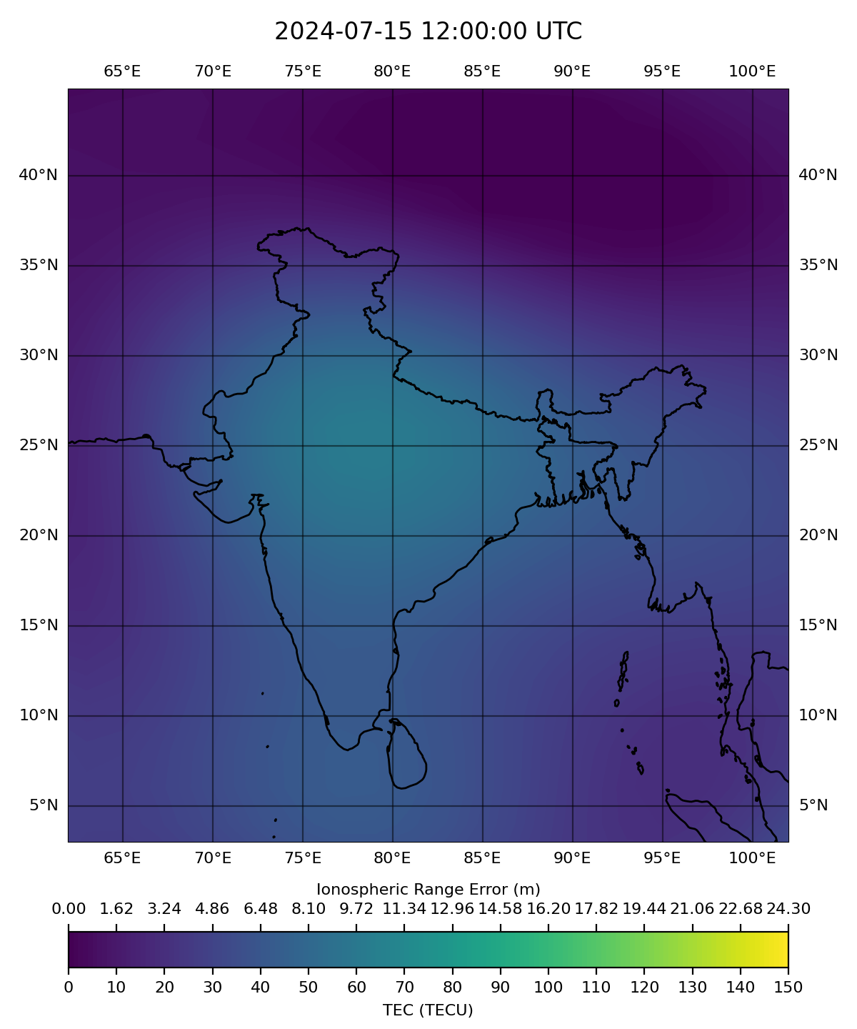
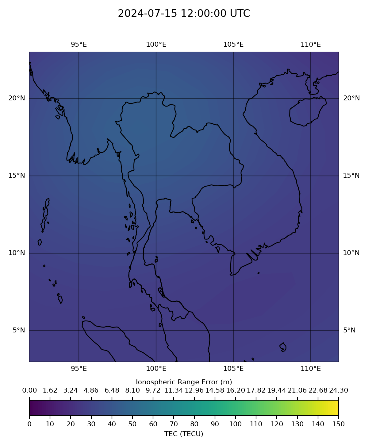
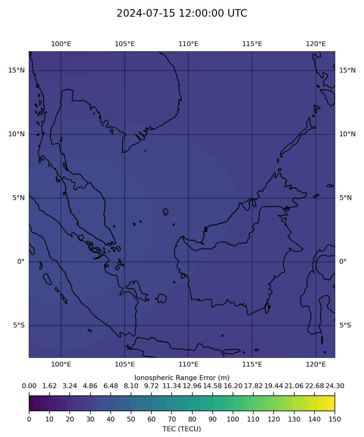
meters of accuracy matters. This research proposes an approach to
map and model the regional Total Electron Content (TEC)
representation using Spherical Cap Harmonic Analysis (SCHA)
[Haines,1988] which, when applied to the whole sphere, is the
usual method referred to as ordinary Spherical Harmonic Analysis
(SHA). The model is based on longitudinal expansion in Fourier
series and fractional Legendre colatitudinal functions over a
spherical cap-like region. The proposed research will take the
advantage of existing IGS, GNSS network in India and Asean partner
countries along with initiating the collaboration with other
universities & nations across the region with GNSS stations.
Details
Space weather which is governed by solar activities is the key
cause of the Sun-Earth interaction system. The Sun-Earth
interaction significantly affects the
magnetosphere-ionosphere-thermosphere system leading to diverse
physical phenomena. Solar eruptions caused due to magnetic
activities of the sun, propagate through interplanetary space and
interact with the terrestrial magnetosphere consequently affecting
the near–Earth space environment and the upper atmosphere. The
earth’s ionosphere is highly affected by the space weather events
such as Coronal mass ejections, geomagnetic storms, solar winds,
and solar flares. The earth’s ionospheric parameters such as
electron density, total electron content (TEC), electron and ion
temperature behaves in a varied fashion to the incoming solar
flux, electrodynamic drift, which makes its prediction very
complicated. These parameters are found to be varying with local
time, season, latitude, longitude, solar activity, and the
conditions on the sun and earth’s magnetic field. The equatorial
and low-latitude ionosphere has been of interest to many
researchers worldwide, owing to its illustrative density and
temperature features, such as the equatorial ionization anomaly
(EIA), the plasma fountain, and the equatorial electrojet. The low
latitude ionosphere is highly influenced by various electrodynamic
processes which in turn introduce large ranges of temporal and
spatial variations during both geomagnetic quiet and disturbed
conditions [Fejer 2010, Abdu 2016]. These variations will affect
the space-based navigation and communication systems that are used
in most of the day-to-day societal applications.
As a well-known fact, the ionosphere is a significant source of
error in satellite navigation systems, such as GPS. In ordinary
operation, the position of a GPS receiver is estimated by
measuring the time delay between a radio signal transmitted from
each satellite and the reception of that signal at the receiver.
Assuming a constant speed of light, this time delay can be
converted to a receiver-satellite distance. By comparing the
distance to multiple satellites a GPS receiver can determine its
three- dimensional position. The ionosphere disrupts this approach
since the GPS radio signal is slowed by the presence of free
electrons, causing an additional time delay and hence an error in
the distance to each satellite. The greater the total number of
electrons on the signal path, the greater the time delay. With our
dependency on satellite-based technologies in various
applications, the studies conducting the responses of the
ionosphere to geomagnetic storms have become inevitable. These
research studies can lead us to understand the energy coupling of
sun –earth interaction system and for forecasting space weather
changes. Thus, understanding the behavior of these geomagnetic
storms across the equatorial region and modeling them to predict
the future impact on the ionosphere and GPS positioning is the
need of the hour.