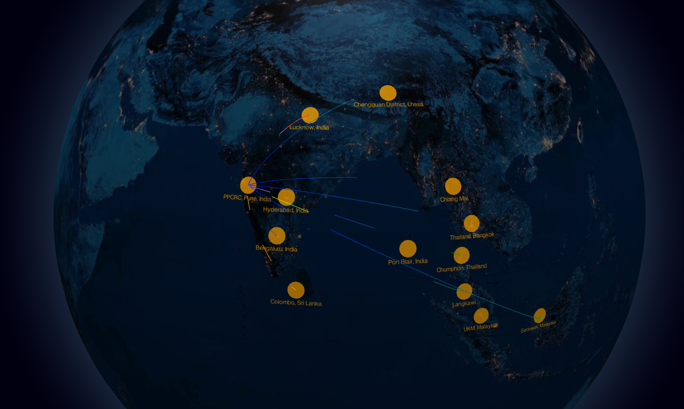
Development of near real-time regional TEC mapping at
low-latitude
Asean region using GNSS stations
Space weather which is governed by solar activities is the key cause
of the Sun-Earth interaction system. The Sun-Earth interaction
significantly affects the magnetosphere-ionosphere-thermosphere
system leading to diverse physical phenomena. Solar eruptions caused
due to magnetic activities of the sun, propagate through
interplanetary space and interact with the terrestrial magnetosphere
consequently affecting the near–Earth space environment and the
upper atmosphere. The earth’s ionosphere is highly affected by the
space weather events such as Coronal mass ejections, geomagnetic
storms, solar winds, and solar flares.The Proposed research aims to
investigate the behavior & impact of geomagnetic storms on GNSS
across the southeast Asian region and to evaluate the GPS
positioning error on L1-band during space weather events by
developing a model for near real-time regional TEC mapping across
the region. Funding Agency: Asean India Science, Technology &
Innovation Cooperation, Government of India.
PI : Dr. V Rajesh Chowdhary, Associate Professor, I2IT Pune
Co-PI: Prof Nitin Kumar Tripathi, Asian Institute of Technology,
Thailand
Co-PI: Prof Mardina Abdullah, Universiti Kebangsaan Malaysia
Proposal submitted jointly by Indian, Thai & Malaysian counter
parts.
Grant : INR 30.27 Lakhs (2019-2021)
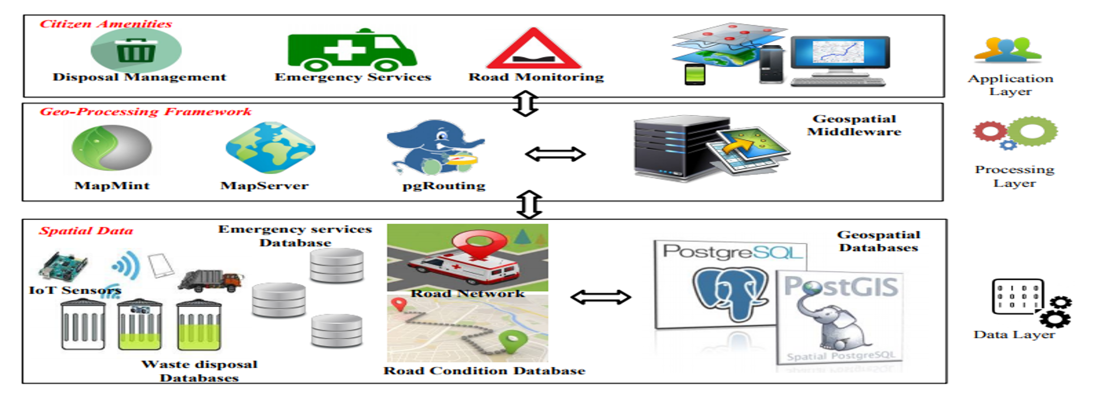
Service Oriented Participatory Platform for Local SDI Smart Civic
Services for Second Tier Cities in Thailand and India
The maturing of geospatial technologies and penetration of Internet
and GPS-enabled mobile devices offers tremendous possibilities in
deploy Societal GIS applications and services in improving access to
civic amenities in both urban and rural areas. The recent advances
in Open Source Software, availability of Open Data, and maturing of
Open Geospatial Standards affords a distinct possibility for
deploying robust and scalable solutions even in second tire towns
and cities in developing economies such as Thailand and India. This
project seeks to leverage Free and Open Geospatial Solutions for
Geoinformatics FOSS4G to deploy a Geospatial platform for civic
services focussing on crucial issues such as waste collection,
maintenance of rural roads, and optimizing emergency medical
services. Funding Agency: International Cooperation (Bilateral)
Scheme: Thailand; Department of Science & Technology, Ministry of
Science & Technology, Government of India.
PI : Dr. Surya Durbha, Associate Professor, IIT Bombay
Co-PI: Dr. V Rajesh Chowdhary, Associate Professor, I2IT Pune
Proposal submitted jointly by Indian and Thai counterparts.
Grant : INR 10.95 Lakhs (2019-2022)
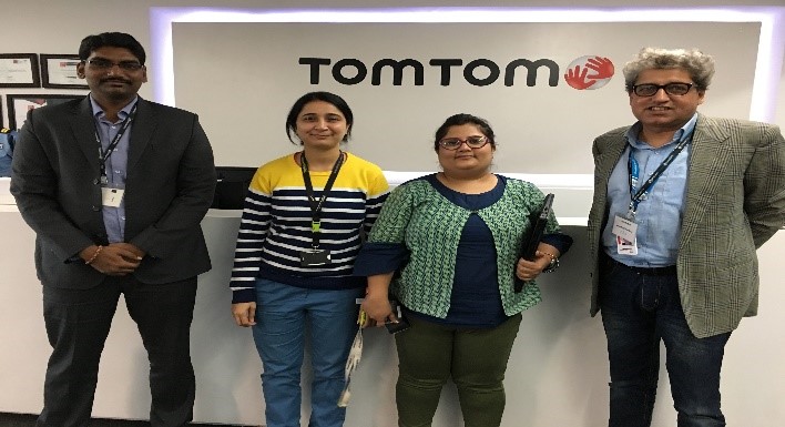
Tori Editor , Realignment , Shifting & Validator
TomTom is the leading independent location technology specialist, shaping
mobility with highly accurate maps, navigation software, real-time traffic
information, and services. In this consultancy project 20 students from I²IT are
participating for validating, realignment, editing various locations/countries
which are finally integrated and deployed in TomTom Map.The prime objective was
to recruit students to perform mini-jobs and to learn the real-life application
of Geographic Information System (GIS), the students became aware of the need
for an always updated map, as well as the complexities associated with keeping
the map up to date
PI : Dr. V Rajesh Chowdhary, Associate Professor, I2IT Pune