Project Details
Introduction
The maturing of geospatial technologies and penetration of Internet and GPS-enabled mobile devices offers tremendous possibilities in deploy Societal GIS applications and services to improve access to civic amenities in both urban and rural areas. The recent advances in Open Source Software, availability of Open Data, and maturing of Open Geospatial Standards affords a distinct possibility for deploying robust and scalable solutions even in second tire towns and cities in developing economies such as Thailand and India.
Objectives
1 . To analyze the town-specific citizen amenities requirements for the townships of Navi
Mumbai and Lavasa in India and Phitsanulok and Phayao in Thailand.
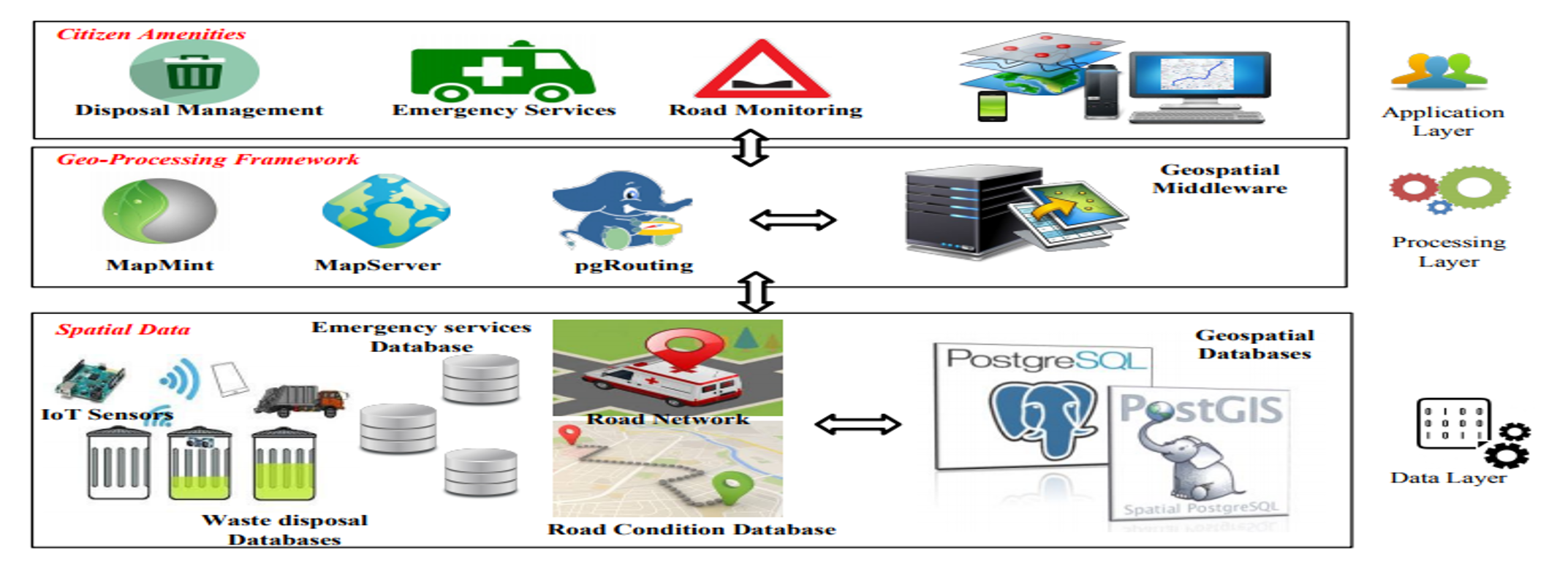
2. To design and develop a holistic, extensible, and scalable crowd-sourced geospatial
framework facilitating citizen amenities such as:
a . Waste disposal Management
Service.
b . Emergency Service (Ambulance Routing).
c . Road Condition
Monitoring
Service.
3. To design and develop mobile and desktop enabled Location-Based Applications for
various citizen amenities implementing the proposed framework
Details
This project seeks to leverage Free and Open Geospatial Solutions for Geoinformatics FOSS4G to deploy a Geospatial platform for civic services focussing on crucial issues such as waste collection, maintenance of rural roads, and optimizing emergency medical services.


